Created 12-Oct-20
Modified 20-Dec-23
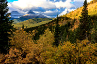
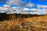
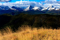
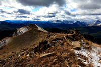
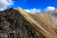
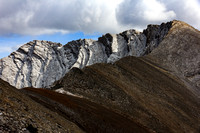
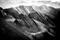
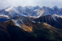
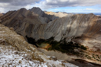
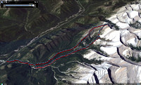
2020.09.26 | Lineham Ridge | 2696 max | 1687 TH | 16.6km | 1454 TA | w/ Peter
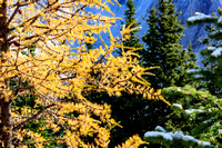
This route was chosen among the varied options for the best of the worst weather forecast, so despite it being still larch season we picked a trip on the fringes of their range and we did see a few. A valley over was madness with people flocking to Ptarmigan and Arethusa cirques parking along hwy 40 for greater than sustainable distances. Hopefully a Covid blip as these once or twice a season hikers come for larch. Ah well – so do I. With some fresh snow we weren’t sure how far we would get and the traditional highpoint where many turn around was satisfying but the higher point called. As I turns out, except for the biting cold wind, it was all doable with no difficulties. Despite the known risk of garbage in the drainage we decided to exit via the valley- as much to get out of the wind as anything. Mostly trailless, there was good hiking until we hit debris from the 2013 floods that necessitated log and rock hopping and numerous traverses of the low creek from bank to bank. A little calm period with mixed sun and cloud had us briefly napping before plunging into the worst of the deadfall creek. The final leg was met with a squall of fresh wet snow and a foreboding darkness. Finishing wet is acceptable and homeward with a hot shower on my mind soon followed.
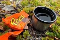
postscript: editing photos in November I'm struck by how many really great shots I got... contrasting colors and texture.
© Clayton Ditzler